
New Products

Product Details

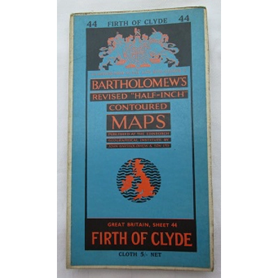

Bartholomew's Revised "Half-Inch" Contoured Map of Firth of Clyde Sheet 44
Units in Stock
1
Product Code:TMP0003
Product Condition:Used
£10.00 inc. tax
Description
You'll never be lost again with this item unless you're not in the Firth Of Clyde at the time. Originally costing 5 Shillings, this Bartholomew's Revised "Half-Inch" Contoured cloth-backed map has survived remarkably well for over 60 years. Intact when fully opened up, there are small holes and tears along some of the folds as well as some discolouration due to ageing. This creates the vintage look to the map. The colour remains vivid and overall the map is very clean with no added annotations. A great piece for someone who collects vintage maps, for someone connected to that area of Scotland or for someone looking at how the Firth of Clyde has changed over the decades.
Date: c.1955
Publishers: The Edinburgh Geographical Institute
Makers: John Bartholomew & Sons Ltd
Made in England
Dimensions (folded): 11cm x 20cm
Dimensions (unfolded): 85.5cm x 59cm
Date: c.1955
Publishers: The Edinburgh Geographical Institute
Makers: John Bartholomew & Sons Ltd
Made in England
Dimensions (folded): 11cm x 20cm
Dimensions (unfolded): 85.5cm x 59cm
Reviews
No Reviews Posted Yet - be the first!
write review


Bartholomew's Revised "..
£10.00